Why
It began with a straight line I couldn't draw.
I was tracing my grandfather Michał's route through the forests of the Wilno region, where he served in the 5th Brigade of the Home Army — the AK. The maps I had, Apple's and Google's, failed me twice. First they couldn't find the places at all: I typed the Polish names from Michał's own notes, but those towns and villages sit in today's Lithuania, Belarus and Ukraine now, under different names in different languages — often not even simple translations. I found each one by hand, with Wikipedia's help, one tedious search at a time.
And when I finally had the points, I still couldn't draw a simple line between them: the apps insisted on routing me through modern border crossings. But those soldiers just walked through the woods. All I wanted was one clean snapshot of that journey — instead I got bold blue zigzags, impossible to read. So I decided to make my own map.
What it is
A quiet tool for making historical maps — the figures for a book about my family.
- Borders that
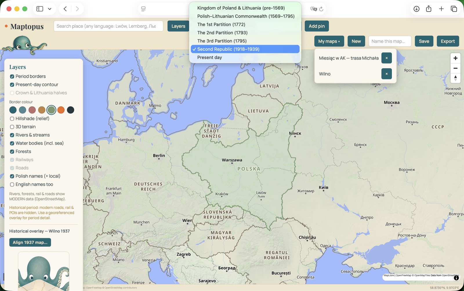
movedPeriod-correct frontiers from open, print-safe historical data — the Commonwealth, the partitions, the Second Republic, today. - People & placesPins for homes, schools, farms and camps — with notes and the names they were known by, in every language.
- JourneysThe routes they walked and were deported along, measured across the real terrain.
- The old plansThe actual 1937 street plan of Wilno, laid precisely over the modern map.
How it's made
I'm not a coder. I'm building it anyway — and somewhere along the way, I became one.
Maptopus is also a record of learning to build with AI: getting to know the tools the way you get to know people, each with its own way of working — almost a personality. Claude gives me structure and quick decisions, and tends to ask a good question before it answers. ChatGPT spills out pages and rarely a straight line, but that wandering turns into playful brainstorming and ideas from another direction. Between the two of them — and a good deal of stubbornness on my part — this got made.
Every border is traced to a source that's safe to print; every old plan is aligned by eye to the ground it maps. A small, personal piece of software, made the way you'd restore a photograph — patiently, with the people in it always in mind.
The story behind the name — and working with Claude and ChatGPT — coming soon